High-resolution borehole images in oil- and synthetic- based muds
Talk to an expertThe Halliburton StrataXaminer imaging service is a wireline logging solution that helps operators acquire more accurate well data, better evaluate production potential, and increase return on investment in oil- and synthetic- based muds. StrataXaminer delivers high-resolution images of the reservoir structure to identify bedding, fracture patterns, fault zones, and potential flow barriers with greater accuracy.
StrataXaminer helps operators better understand the structural complexities in their reservoir and make more informed drilling, completion, and production decisions.
High-resolution borehole images in oil- and synthetic-based muds
02:51
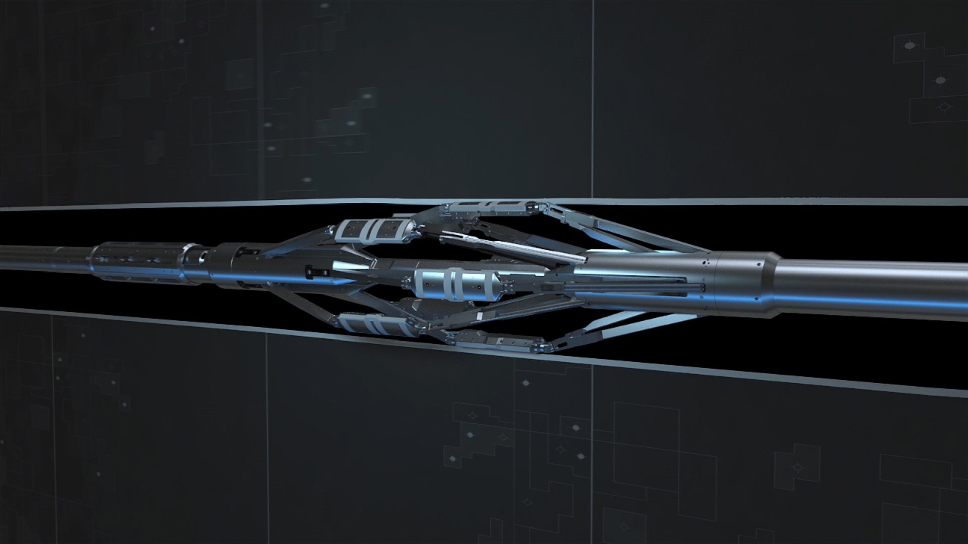
StrataXaminer imaging service transmits high-resolution images of the reservoir structure to identify bed dips, open and closed fractures, fault zones, and potential flow barriers with increased accuracy. Eight imaging pads, with 24 buttons each, use high-frequency signals coupled to the formation to acquire the sharpest images in oil-based mud.
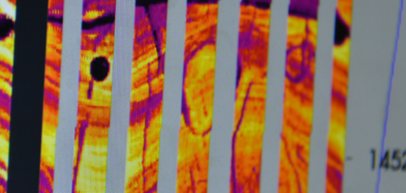
Resolution images of the reservoir
Operating frequencies—an industry first
Pass produces one optimal blended image
Image coverage in an 8-inch borehole
This technology simultaneously captures downhole electrical images at three operating frequencies —an industry-first. This enables operation with oil- or synthetic-based drilling fluids that typically make realistic formation images more difficult. During pre-job planning, operators can set the frequencies to enhance the tool's range according to local geology and define parameters during processing to select the best frequency for given formation responses.
The eight-arm StrataXaminer produces 100 percent image coverage in an 8-inch borehole, using a patent-pending pad carrier to allow up and down logs. In-tool memory increases combinability and helps decrease the number of runs to save valuable rig time. StrataXaminer imaging service integrates fully with other Halliburton solutions, including Xaminer® sonic imager service.
The XRMI provides high resolution formation images in conductive, water-based mud systems.